災害レポート
Sunday June 23, 2002
Preliminary Report of IIEES Reconnaissance Team
The Changureh (Avaj) Earthquake of June 22, 2002 (Mw6.4)
The Changureh (Avaj) earthquake of June 22, 2002
Sassan Eshghi; PhD (s.eshghi@dena.iiees.ac.ir)
Mehdi Zare; PhD (mzare@dena.iiees.ac.ir)
Mohammad R. Mahdavifar; MSc (mahdavif@dena.iiees.ac.ir)
1. Introduction
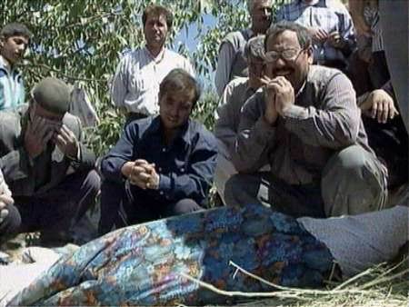
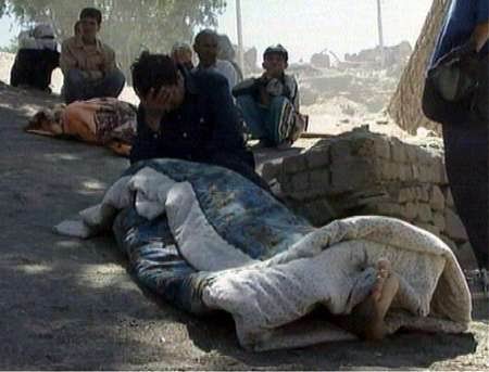
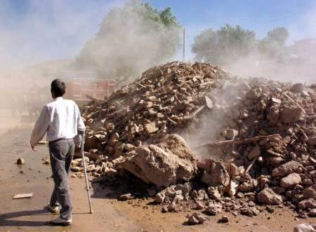
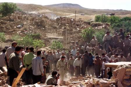
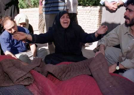
The Changureh (Avaj) earthquake of June 22, 2002 (7:28:00 a.m. local time, 2:58:27.2 GMT) has shocked the NW Iran (about 250km west of Tehran; Fig.1). The region is located in the west of Takestan-Hamedan road along an east-west oriented valley in the west of the Abegarm village. The localities of the greatest damages are the villages of Abdarreh and Changureh (Fig.1). The most recent report on life losses says about 261 death person and 1300 injured people. The earthquake impressed generally about 50 villages (most of them partially damaged). The macroseismic intensity of VII-VIII (in EMS-98 scale) could be assigned to the mentioned villages in the epicentral area.
2. General Tectonic Setting
The structural trends in this region are formed based on the east-west trend fault lines (along the Ipak fault which arrives to the Abegarm village), and the NW-SE fault lines in form of northern Central-Iran. The Ipak fault has interrupted the Avaj valley in the north of Abegarm (just in the eastern parts of the meizoseismal zone). The earthquake has evidently happened along the major WNW-ESE trend of an apparently hidden fault. The surface east-west fissures are observed in the north of Changureh caused by the 22 June 2002 earthquake. The surface fissures could be related to the compressional mechanism; (Fig.2) (as it is supported by the estimated focal mechanism reports coming from the international seismological organizations). The trend of the major damaged area is in the western continuation of the Ipak fault that terminates in the general region of Abegarm. The elongation of the meizoseismal trends gives as well a general near east-west trend.
3. The Extent of Damage
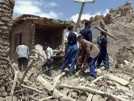
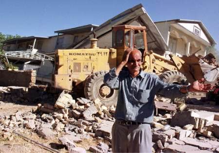
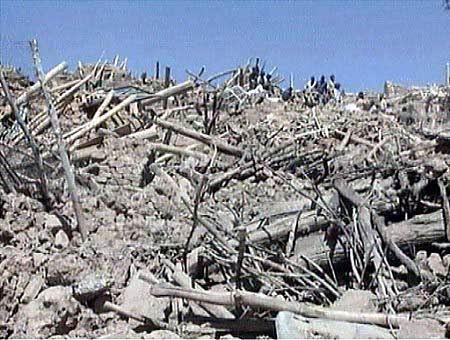
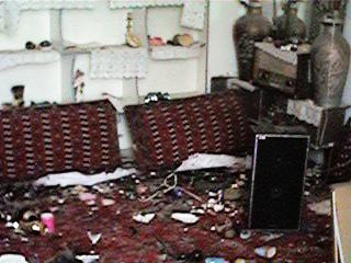
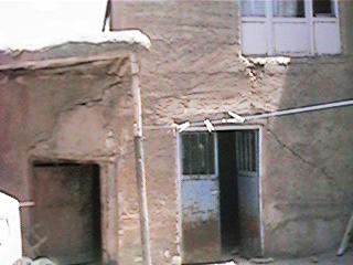
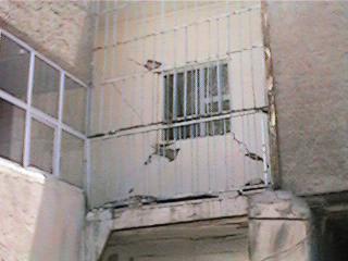
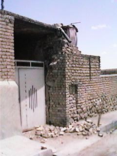
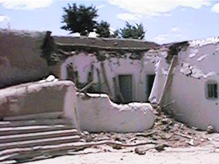
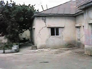
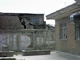
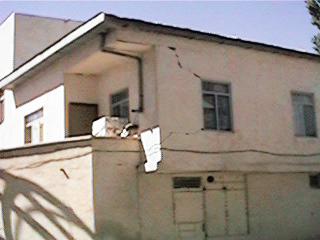
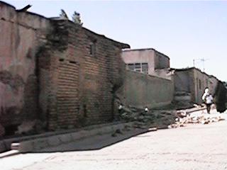
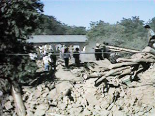
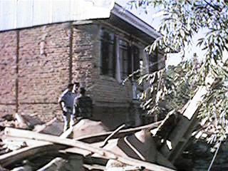
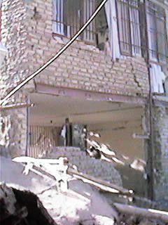
The structural damage to rural buildings were extended in a region mainly between Avaj in the south and Abegarm in east and Shirinsoo in the west and Abhar in the north. Most of the buildings were single storey and made up of adobe (Fig.3) and masonry(Fig.4) materials. They were mostly non-engineered structures and could not withstand seismic forces. The structural failure and collapse resulted from wall to wall separation, lack of structural integrity, lack of proper lateral resisting system and non-ductile materials. Structural collapse was widespread in Changureh and Abdarreh.
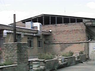
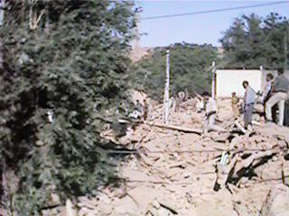
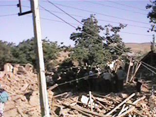
Electrical local network was disrupted and it was partially restored after 8 hours (Fig.5). Water and irrigation systems were damaged severely in the meizoseismal zone. A simple span bridge near Changureh village was partially damaged (Fig.6).


- Date-Time
- 2002/06/22 7:28 (Local)
- Location
- 35.67 48.93
- Depth
- 10 km
- Magnitude
- 6.3
- Region
- 225 Km West of Tehran (Avaj)